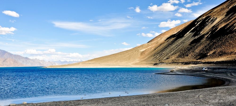
One of the most beautiful lakes, Pangong Lake is almost 160 miles from the town of Leh. It is a journey of 5 hours through huge monasteries and extensive mountains. On your journey you will also cross the third highest pass in the world known as Changla pass accessible by motor vehicles. This Pangong lake travel guide will give you major features to find around the lake and on your way to the lake.
Pangong Tso Lake
In the Tibetan language pangong tso is a long narrow lake. In Indian language Pangong means “A patch of meadow”. The lake is at a height of 4350m above the sea level and has a length of over 134 km. At its widest part it is only 5 km. many people like to tour the area to watch the lake. It freezes to a higher depth during the winter season despite its distinct blackish water.
The lake also changes its color. During the day it is usually blue in color when the sun is high, turquoise color on its banks, and deeper blue at the middle. As the sun moves, it continues to change the color and losing its shades turning duller.
What you will see in Pangong Tso Lake
In the lake you will never find fish or other aquatic animals or plants. The lake has never supported life although it has some micro vegetations and small crustaceans. The place is also a habitat for many ducks and gulls. Additionally, the lake is a breeding ground for almost all the local and the migratory birds. The birds and ducks create good scenery around the lake which is highly admired by tourists.
Tourist like the area due to the large population of Brahmin ducks and bareheaded goose not found in many parts. Some tourists at times are usually lucky to spot some wild animals like kiang, which is a wild ass, and a brownish rodent of the squirrel family called marmot. The marmot likes to live within burrows around the lake but may also live on the surface.
Marshes around the lake are of various species making perennial herbs and shrubs. The khurnak attraction is another major tourist attraction. The fort lies halfway across the lake on the northern bank.
How to reach Pangong Lake
The journey from leh to the lake is also an important 5 hr drive. You will have to cross one of the top three highest mountains pass in the world. Getting there, you will pass through Shey and Gyey village and then the Changla pass where you will see the army sentries.
In the Changla pass there is also a small tea point for refreshment. Along the road, you will see the long barley fields which is the main source of food for the people in the area extremely harsh around 4000 meters above the sea level.
The road from Changla to the lake rises steeply on its one side and on the other side, it steeply drops into the valley hence one of the dangerous routes. The fact that the road has no rails or barriers guarding vehicles from falling makes it worse. Drivers passing through the route are always extra careful to prevent any accident. In the road, no over taking happens without the participation of both drivers.
After Changla you will now get to Tangste after passing through many small villages which dot hills in the area. After Tangste, you will get into an area with only bare rocks and dust. As a tourist you will be fortunate to view the snow filled mountain called Mount Laden. After the mountain, you will then reach at the point where Changla pass crosses a stream known as Crazy stream.
You will now be overjoyed to have reached the lake. As a first time tourist, you stand in amazement looking at the large mass of deep blue water body shinning alongside the yellow looking mountains which most of the time will have snow dust.
The lake is around the indo-china border where security is rigid to protect tourist around the area. The control line happens to pass right across the lake making it a disputed area. Before entering the secured areas, you will need to show your permits or passport for security purposes. As a tourist, you can only reach the Merak village.
At the lake, you will not only see tourists. Many geologists from all parts of the world frequently visit the area.
